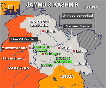
History of the Kashmir Conflict
The state was originally one of the domains of the the Sikh Kingdom of Ranjit Singh. The British defeated Singh in 1846 and sold Kashmir to Ghulab Singh of Jammu, who later conquered Ladakh and named himself Maharaja. This entity was the origin of the bewildering modern state, which includes three, culturally distinct and strikingly different regions: 1) Kashmir (Moslem-dominated), 2) Jammu (Hindu-dominated), 3) Ladakh (Buddhist-dominated). His sucessors, Ranbir Singh, Partab Singh, and Hari Singh ruled until the Independence of India in 1949.
|
Religious groups:
Indian-administered Kashmir
|
|
REGION
|
Buddhist
|
Hindu
|
Muslim
|
Other
|
|
Kashmir Valley
|
-
|
4%
|
95%
|
-
|
|
Jammu
|
-
|
66%
|
30%
|
4%
|
|
Ladakh
|
50%
|
-
|
46%
|
3%
|
The rest of J&K's history is controversial. During the Partition, the Maharaja was given a choice by the British to either join India or Pakistan. There was hesitation on the part of the Maharaja. Pakistan launched a surprise invasion, that led to the capture of almost half the state (see Pakistani Kashmir on map above) before the Indians retaliated and pushed back. In 1949, a UN-brokered cease-fire was declared, which established the famous "Line-of-Control" [LoC], which did not shift significantly during the 1965 Indo-Pak War (below).
The 1971 war between India and Pakistan led to the splitting of East Pakistan into modern-day Bangladesh. In 1989, militancy broke out in the Kashmir Valley. It was initially a string of kidnappings and riots in 1987 and 1988, but by 1989, it expanded into a full-scale insurgency, with Kashmiri's Hindu community (Pandits) fleeing to Jammu and Delhi while the military and police entered into a war footing. The militancy has continued to the present day.
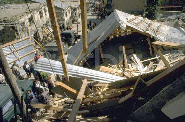
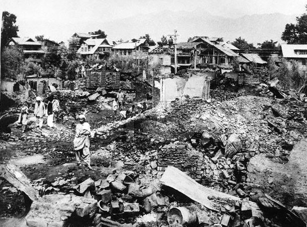
Since 1999, there has been periodic episodes of cross-border shelling, in which Indian and Pakistani howitzers take pot-shots at each other. Often, villages are hit (above). (See Devipur Border Migrant camp).
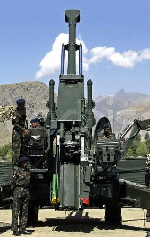 |
Indian army soldiers, during Vijay Diwas or Victory Day celebrations, displays a heavy artillery gun which was used during war with Pakistan, in Drass, 160 km (99 miles) east of Srinagar, in this picture taken July 26, 2004. |
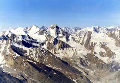
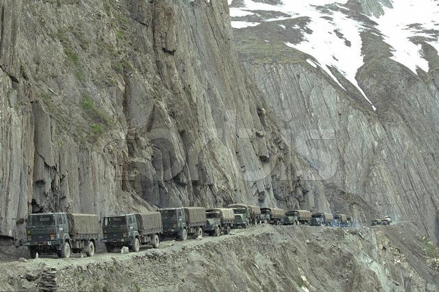
In 1999, Pakistan armed and trained soldiers to covertly enter J&K through the north (see BBC map) through the treachorous mountains of Kargil (see above). There had never been previous conflicts in these areas because the mountains are unpassable and unpatrolled during the Winter. The principal aim seems to have been to open a conduit for militants, who have routinely intruded into J&K during the past 15 years from the Jammu-Kashmir border to contribute to the militancy. It is also speculated they were trying to cut off the crucial Srinigar-Leh highway (on which my final medical camp was located). The cover Pakistani soldiers initially entered about 6-8km into IOK, claiming peaks ranging from 5,000 to 18,000 feet. The hawkish Indian BJP government responded with a harsh aerial bombardment campaign using MiGs.